Winterborne Stickland
|
Winterborne Stickland |
|
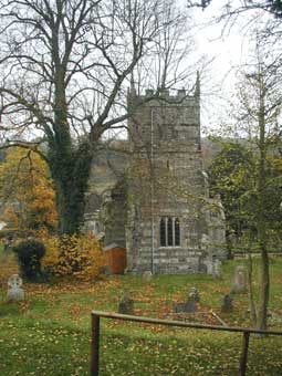
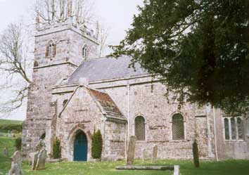
Winterborne [or Winterbourne] Stickland [or Strickland] is a parish and village situated at the head of the chalk stream Winterbourne, situated 3¾ miles south west of Blandford Forum. To the north is the parish of Turnworth, to the east is Blandford St Mary, downstream is Winterborne Clenstone and on the west is Winterborne Houghton. The parish church of St Mary is in the middle of the parish and is noted for the oak waggon headed roof. The registers date from 1616 but some are missing. |
|
|
|
A Wesleyan Chapel was built in 1863 and a Primitive
Methodist Chapel in 1877. Winterborne Quarleston is a tithing in
the parish The village had a post office, a National School built in
1861 and a Police Constable. The parish comprises 2234 acres, the soil
is light chalky loam and the chief crops were wheat and barley. In 1891
the population was 406. |
|
|
| Census | 1841 Census [Joan McCullough] 1851 Census [Kim Parker] 1861 Census [Ruth Hawkins] 1871 Census [Ruth Hawkins] 1881 Census [Ruth Hawkins] 1891 Census [Ruth Hawkins] 1901 Census [Ruth Hawkins] |
| Parish Registers |
The Parish Registers date from 1616, the Bishops Transcripts date from 1731 Baptisms 1813-1883 [Kim Parker] Marriages 1754-1837, 1837-1945 [Ruth Hawkins] Burials 1813-1940 [Kim Parker] |
| Bishops Transcripts | Burials 1813 - 1837 |
| Rectors | A list of the Rectors of the Parish from 1217 |
| War Memorial | Photo and names of those commemorated on the War Memorial |
| Monumental Inscriptions | An on-line index of all names on Memorial Inscriptions with further details being available |
| Photographs | More Photographs of the church & village |
| Maps | |
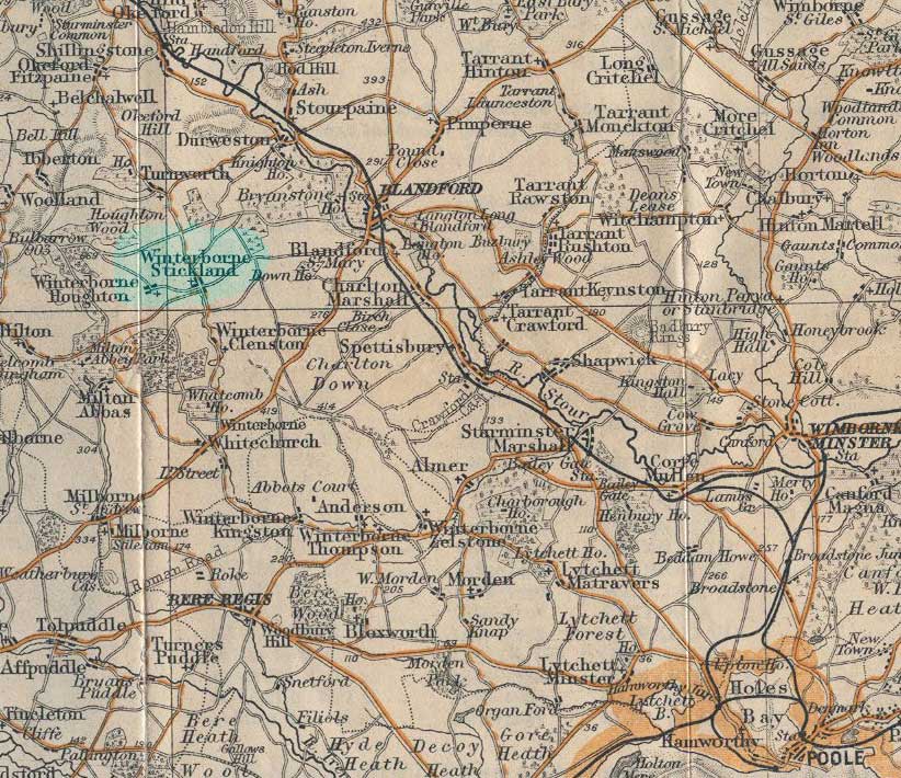 |
For a 1920s map of the area click on the thumbnail on the left |
|
View Larger Map |
|
| Records held at the Dorset History Centre [Ref PE-WSD] |
Registers Christenings 1615-1783, 1797-1799, 1813-2004. Marriages 1616-2002. Burials 1615-1969. |
| Registration District
(for the purpose of civil registration births, marriages & deaths) |
1 Jul 1837-30 Jun 1956: Blandford 1 Jul 1956-31 Mar 1974: Poole 1 Apr 1974-17 Oct 2005: North Dorset |
Visitors to Dorset OPC
Copyright (c) 2025 Dorset OPC Project